PRECISE
Unmatched Accuracy
Mark coordinates with laser precision as fine as 3/100’ (8mm) with CivDot+ and up to 1/10’ (30mm) with CivDot - Ideal for construction staking in challenging terrains with tilt compensation.

SIMPLE
Anyone Can Operate It
Using Civ Robotics requires no prior land surveying experience. EPCs can hire general labor to operate this equipment, from Alex, the intern, to John with 20 years in the field.
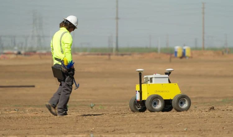
EFFICIENT
Lay Out 8x Faster
A traditional surveying crew lays out between 200 - 450 points daily. With CivDot, one operator can mark between 1,000 to 5,000 points/day depending on spacing and accuracy tolerances.

20GW
SOLAR FARMS & RENEWABLE ENERGY PROJECTS
+10M
MARKED COORDINATES
5
CONTINENTS
Testimonials
Here's what top EPCs share about us
Contact Us
Loading form...
© 2026 Civ Robotics inc. All Rights Reserved.