
Leverage GNSS Receiver’s Full Potential
Designed for exceptional accuracy and efficiency, CivDot+ equips a single operator to mark up to 1,200 points daily, perfect for tight-tolerance construction projects.
Harnessing dual-RTK, IMU, and a robotic arm, CivDot+ maximizes the GNSS receiver's potential, achieving an impressive 3/100' (8 mm) accuracy.
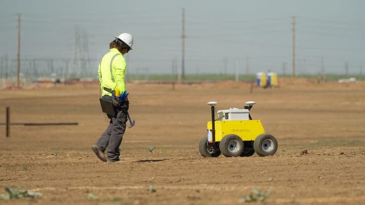
The CivDot+ is a rugged 4WD rover with 10" ground clearance that can handle challenging terrains and harsh climates.
Transform how coordinates are selected, captured, and managed, streamlining your construction site's layout process.
Working with Market Leaders
CivDot+ connects with top brand base stations like Trimble, Topcon, Leica, or NTRIP network for RTK corrections.


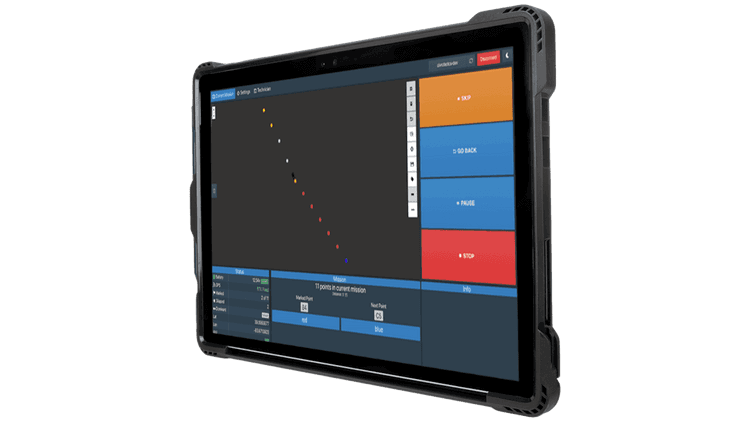
Simple Operation with CivPlan Software
CivPlan, our preinstalled surveying software, makes data preparation and field operation management fast and user-friendly, no license or surveying experience needed.
Operate the construction layout robot safely from up to 100’ away, enhancing construction site safety and control.
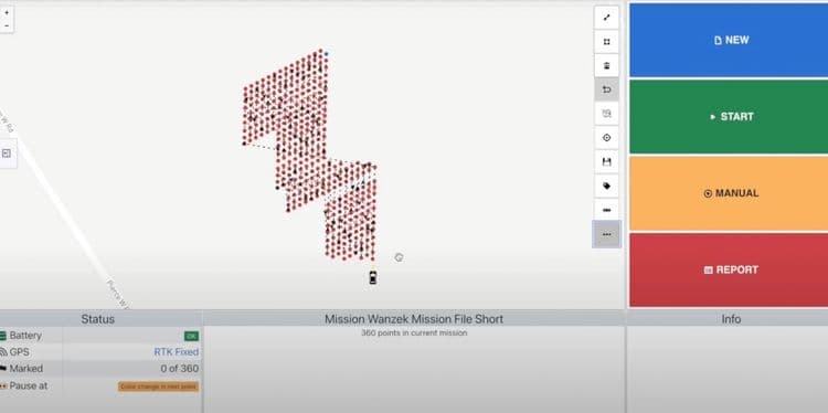
Mission Planning
Upload a CSV file with coordinates, select your first point and direction for layout optimization, and send your autonomous survey robot into action.
Field Operation
The robotic layout system spray paints at the precise location using GNSS receiver data. Follow behind to place construction layout tools like flags, nails and whiskers, or stakes.
A built-in speaker announced each coordinate with a description, enabling smooth, efficient construction layout.
Real-time Reporting
Get instant access to real-time reporting that includes marked coordinates, ground elevation, and tolerance. Make informed layout decisions without waiting for delayed data from the field.
Discover the power of CivRobotics

Connect with us today to learn more. →
© 2026 Civ Robotics inc. All Rights Reserved.