
Safety First
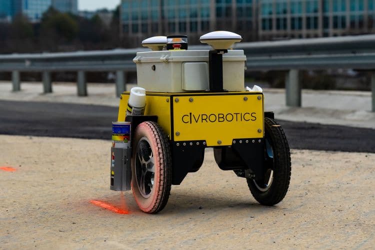
No more pulling tape and string lines. CivDot Mini equips contractors to stripe more quickly and seamlessly. Mitigate risks and ensure worker safety with remote operations.
Engineered for road markings, parking lot striping, airports, and more. CivDot Mini is redefining the way lines are laid out.
Mark 17 miles of lines daily; choose between solid or dash lines. Civ’s sensor fusion ensures sub-inch accuracy of line work.
With a dedicated space for carrying two additional spray cans, and a featherweight design of only 50 lbs, CivDot Mini is the ultimate on-the-go solution.
Working with Market Leaders
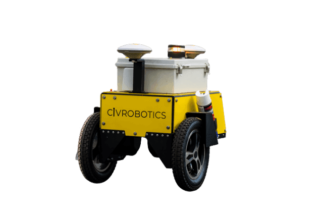
CivDot Mini is compatible with Trimble R780 GNSS receiver. Leverages Trimble’s TIP technology to survey faster with IMU based tilt correction.
CivDot Mini connects with top brand base stations like Trimble, Topcon, Leica, or NTRIP network for RTK corrections.

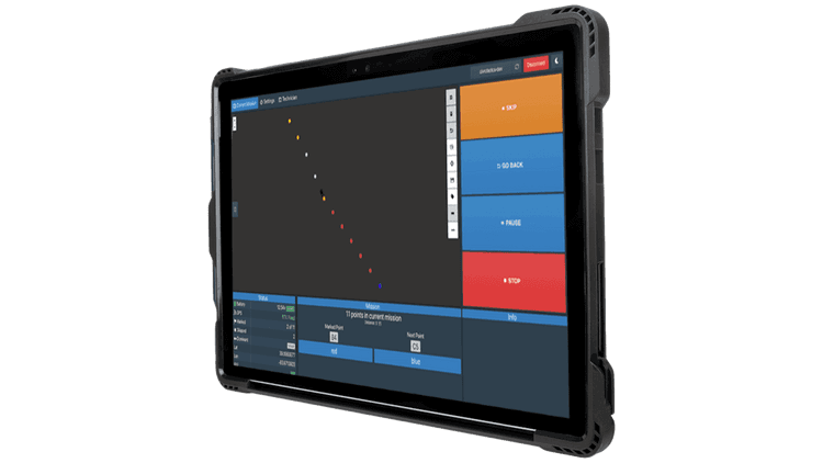
Easy Operation with CivPlan
Robust technology at your fingertips with CivPlan - a preinstalled software that makes data prep and filed operation management easy for everyone.
Enable Safe operations from up to 100' away.
Mission Planning
Upload your blueprints in DXF format, and select your preferred order for marking the lines. Next, choose between dash or solid, and send CivDot Mini on its marking mission.
Field Operation
Follow CivDot Mini and change the spray can when CivPlan asks you to. The CivDot Mini has space to carry two extra spray cans.
Real-time Reporting
Generate detailed reports of marked coordinates with respective time stamps, tolerance level, and ground elevation. Make informed decisions without waiting on separate data submissions or calculations.

Stripe with Confidence

Connect with us today to learn more. →
© 2026 Civ Robotics inc. All Rights Reserved.