
Enhance Productivity with Automated Layout Technology
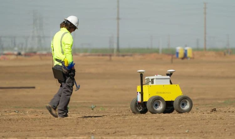
Layout and stake with CivDot, the high-precision construction layout robot that automates your workflow. Mark up to 3,000 points per day, up to 8x faster than manual methods, with accuracy down to 1/10’ (30 mm).
The CivDot is a rugged 4WD rover with 10" ground clearance that can handle challenging terrains and harsh climates.
Compatible with leading GNSS receivers like Trimble R780, it delivers unmatched speed, accuracy, and simplicity in construction layout.
Working with Market Leaders
CivDot is compatible with Trimble R780 GNSS receiver. Leverages Trimble’s TIP technology to survey faster with IMU based tilt correction. CivDot connects with top brand base stations like Trimble, Topcon, Leica, or NTRIP network for RTK corrections.


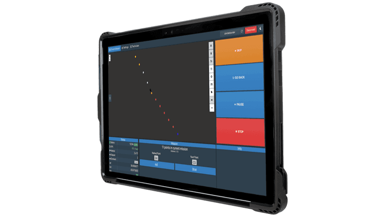
Easy Operation with CivPlan
Robust technology at your fingertips with CivPlan - a preinstalled software that makes data prep and filed operation management easy for everyone.
Enable Safe operations from up to 100' away.
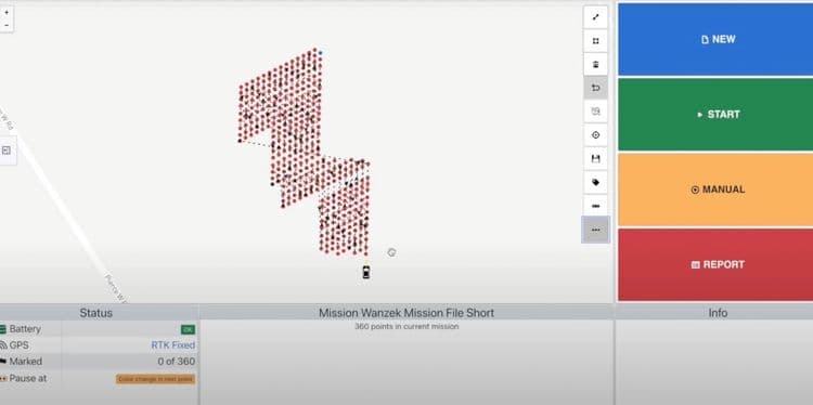
Mission Planning
Upload a csv file with a list of coordinates, select your first point and direction for route optimization, and send CivDot+ on its marking mission.
Field Operation
CivDot+ laser points at the exact position of the coordinate. Follow behind to mark with your choice of physical marker - flags, nails and whiskers, paint or stakes.
The inbuilt speaker directs the operator with a point description, making markings as seamless as possible.
Real-time Reporting
Generate detailed reports of marked coordinates with respective time stamps, tolerance level, and ground elevation. Make informed decisions without waiting on separate data submissions or calculations.
Discover the power of CivRobotics

Connect with us today to learn more. →
© 2026 Civ Robotics inc. All Rights Reserved.